Command Line Tools
GeoTiler Lint Script
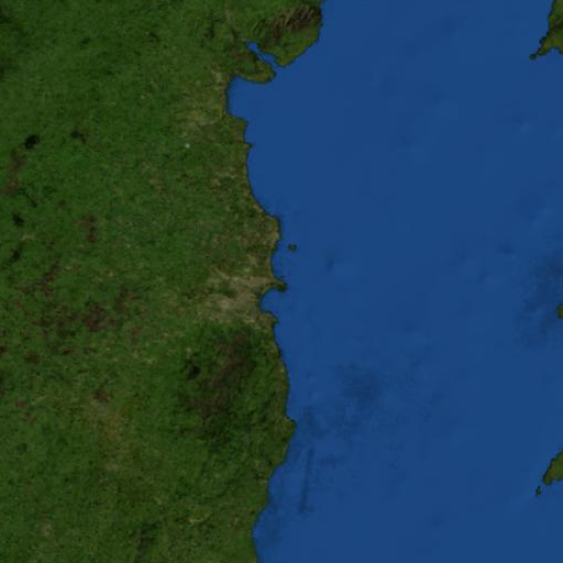
GeoTiler provides geotiler-lint script, which can be used to create a map image from command line.
For example, to create a map image using Blue Marble map tiles provider, map center, zoom and map image size:
geotiler-lint -c -6.069 53.390 -z 8 -s 512 512 -p bluemarble map-bluemarble.png
The script supports all implemented map tiles providers. Map can be specified with any of the required map parameters combination. It allows to switch map tiles caching strategy to use Redis cache.
Route Drawing
The geotiler-route script can be used to draw position information on a map. The script uses GPX file (can be compressed with Gzip, bzip2 or xz) as its input.
For example:
geotiler-route path.gpx map-path.png
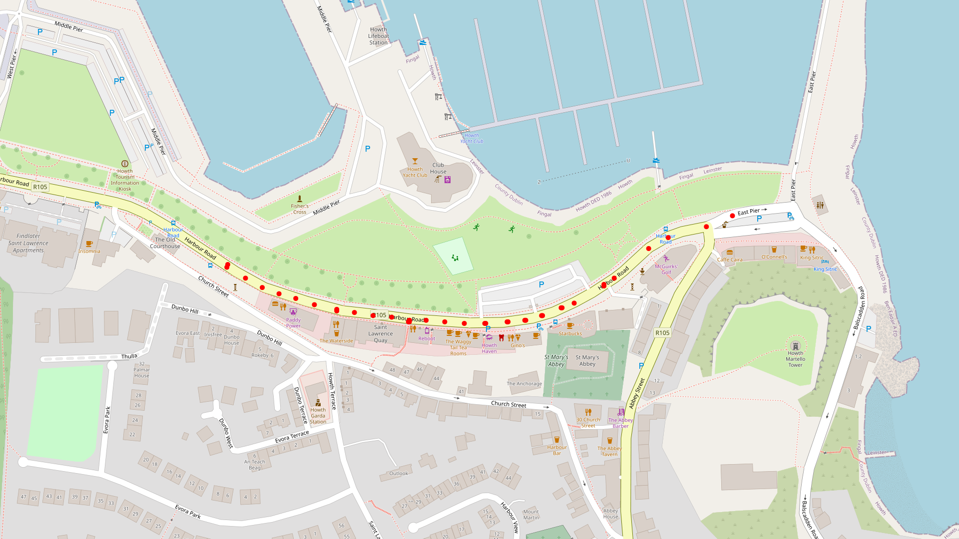
The map extents are determined by aggregating positions stored in the input file. The map zoom is automatically calculated from the map extent and map image size.
Map Tiles Fetching
The geotiler-fetch script enables us to fetch map tiles and store them in cache to be reused later by a map application. Optionally, map image can be saved to a file for each zoom level.
To fetch OpenCycleMap tiles and save map images into files named map-01.png’, `map-02.png, …, map-19.png:
geotiler-fetch -p tunderforest-cycle -f 'map-{:02d}.png' -6.0759 53.3830 -6.0584 53.3945